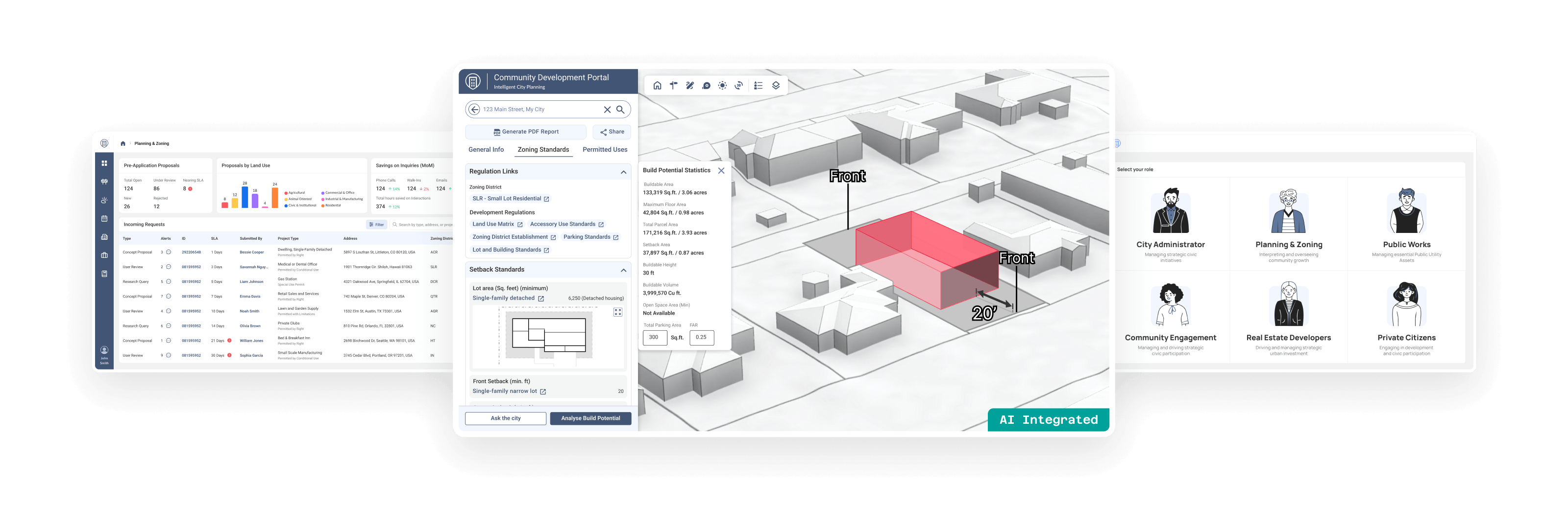
One Source One System One Connected Community
Urban360 platform allows users and city staff from different functions come together to serve a common goal of advancing community goals. It is designed to maximize your GIS investments by binding them through unified workflows creating a stronger two-way communication to accomplish its community planning goals.
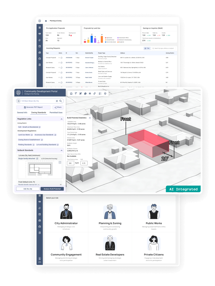
One Source One System One Connected Community
MuniSync360 platform allows users and city staff from different functions come together to serve a common goal of advancing community goals. It is designed to maximize your GIS investments by binding them through unified workflows creating a stronger two-way communication to accomplish its community planning goals.


