ViewPro
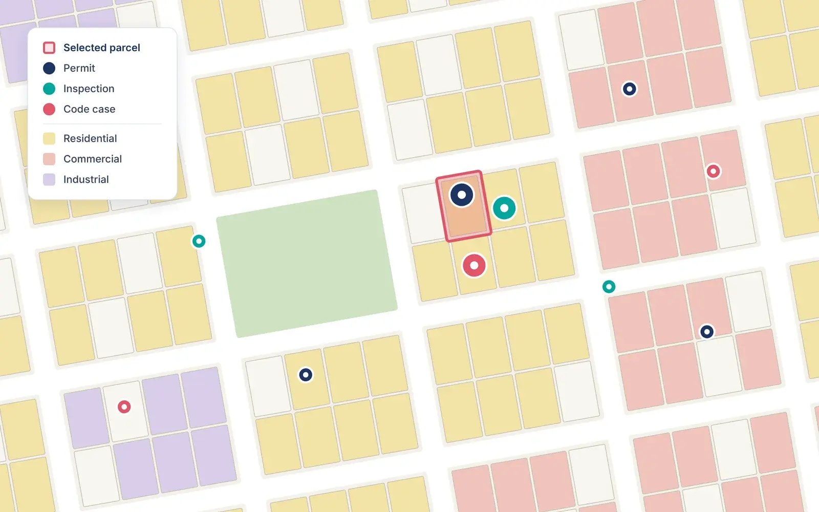
Community development software is the system a city or county uses to manage how land gets planned, built on, inspected and kept safe. It brings planning and zoning, permits, inspections, code enforcement and related work into one place, so every department works from the same records instead of separate spreadsheets, paper files and disconnected apps.
What community development software means
In local government, "community development" usually refers to the departments that shape the built environment: planning, zoning, building, code enforcement, and often economic development and public works. Community development software is the shared platform behind that work.
At its simplest, it answers three questions for staff and residents:
- What is allowed here? Zoning, land use, overlays and plans for a parcel.
- What is happening here? Open permits, inspections, cases and work orders at an address.
- Who needs to act next? Which reviewer, inspector or crew owns the next step.
You may also see it called land management software, permitting and licensing software, or community development and permitting software. The labels overlap; what matters is whether the system connects the work across departments or just digitizes one of them.
What community development software covers
Most platforms are built from the same core functions. Cities rarely need all of them on day one, but each one leans on the same underlying data: parcels, addresses and people.
| Function | What it handles | Who uses it |
|---|---|---|
| Zoning and land-use mapping | Zoning districts, overlays, future land use, parcel lookups | Planners, residents, developers |
| Comprehensive and long-range planning | Plans, scenarios, community input tied to geography | Planning directors, councils |
| Development review | Applications, plan review, comments, approvals | Planners, engineers, applicants |
| Permit tracking | Building and trade permits from application to approval | Permit techs, contractors |
| Inspections | Scheduling, field results, photos, re-inspections | Building inspectors |
| Code enforcement and case management | Violations, complaints, notices, case history by location | Code officers |
| Work orders and asset management | Assigning and closing field work, asset condition | Public works, utilities |
| Public-facing portal | Self-service lookups, applications, status checks | Residents, businesses |
| Reporting and dashboards | Volumes, turnaround times, workload by area | Managers, city leadership |
The important design choice is not the list of modules. It is whether those modules share one record of each property, or pass data between each other through exports and re-keying.
In a connected system, each step adds to the same record, so a permit's history stays attached to the property long after it closes.
Why location is the backbone
Almost everything community development touches has an address. A permit sits on a parcel. That parcel sits in a zoning district. An inspection, a code complaint and a broken hydrant all happen somewhere specific.
That is why GIS (geographic information system) data is the natural backbone for this kind of software. When permits, cases and work orders live on the same map as zoning and parcels, staff can see the full picture of a property in one view. A planner reviewing a site plan can see open code cases next door. An inspector in the field can pull up permit history on a tablet. A city manager can see where development is concentrating.
Systems that treat the map as an add-on tend to drift out of sync with the city's GIS. Systems built on the city's existing GIS, such as Esri ArcGIS, keep one authoritative version of parcels and addresses that every department uses.
What cities gain
- Faster turnaround. Applications move to the next reviewer automatically instead of waiting in an inbox or on a desk.
- Fewer errors. Data entered once is reused across permits, inspections and cases, so there is less re-keying.
- Better coordination. Planning, building, code and public works see the same record of a property, which cuts down on emails and phone tag.
- Self-service for residents. Common questions like "What is my zoning?" or "Where is my permit?" can be answered online, freeing staff time.
- Field-ready work. Inspectors and crews capture results, photos and notes on site instead of transcribing them later.
- Clearer reporting. Leadership can see volumes, bottlenecks and trends by area without waiting for someone to build a spreadsheet.
Signs your current setup is holding you back
Many cities already have some software in place. These are common signals that it is no longer enough:
- Staff answer the same zoning and permit-status questions by phone every day.
- Permit, code and work order records live in separate systems that do not talk to each other.
- Inspectors write results on paper and enter them back at the office.
- The GIS team is the bottleneck for every map request.
- Producing a monthly report means exporting and merging spreadsheets by hand.
- Development requests are growing faster than headcount.
How to evaluate community development software
Use these questions when comparing vendors:
- Does it build on the GIS you already have? If your city runs Esri ArcGIS, ask whether the platform uses your parcel and address layers directly or keeps its own copy.
- Does it connect departments, or just one? A permitting tool that cannot see code cases or work orders will recreate the silos you are trying to remove.
- Can it integrate with your existing systems? Finance, ERP, document management and online code platforms should connect without manual exports.
- Is it usable without heavy training? Staff adoption decides whether the system succeeds. Ask to see it with your own data.
- Does it work in the field? Inspectors and crews need mobile access that works on site.
- What does the public see? Look for a resident-facing map or portal that answers routine questions on its own.
- Who implements it? Ask about the vendor's experience with local government and with your GIS platform, and who supports you after go-live.
- Where is AI useful, and where is it hype? Ask for specific tasks AI handles today, how outputs are checked, and how your data is protected.
Where MuniSync fits
MuniSync is ViewPro's community development platform: one map for every department's data, teams and work. Instead of adding another standalone system, it puts zoning, parcels, permits, inspections, code cases, work orders and assets on the same live map, built on Esri ArcGIS.
- Planning and zoning: zoning and land-use mapping, and comprehensive planning that brings plans, data and community input together.
- Permitting and inspections: follow each permit from application to approval, and schedule and log inspections from the field.
- Code enforcement: track violations and cases by location.
- Public works: assign, track and close work orders on the map, and keep tabs on asset condition.
- Data integration: connect the systems your departments already use.
MuniSync.ai adds AI tools designed for cities and local government on top of that connected data.
ViewPro is an Esri Partner Network member with the State & Local Government Specialty, and also provides ArcGIS implementation, GIS data services and custom map-based applications. See how the City of Burkburnett, Texas, modernized work order management with ArcGIS with ViewPro.
Book a demo to see MuniSync with your own city's data.
Frequently asked questions
Is community development software the same as permitting software?
No. Permitting software is one part of it. Community development software also covers planning, zoning, inspections, code enforcement and often work orders, all tied to the same property records.
Who uses community development software?
Planning and zoning staff, building officials, inspectors, code enforcement officers, public works crews, city leadership, and residents and contractors through public portals.
Do small cities need it?
Smaller cities often feel the pain most, because a few staff cover many roles. A connected system lets a small team answer questions and move applications without chasing records across tools.
Why does GIS matter so much?
Nearly every permit, case and work order is tied to a location. Building on the city's GIS keeps one authoritative version of parcels and addresses that every department relies on.
How does AI fit in?
AI can help staff find information, summarize records and handle routine questions faster. It works best on top of clean, connected data, which is why the platform underneath matters first.